Frontiers of the Roman Empire, The Antonine Wall UNESCO World Heritage Site
The Antonine Wall was an ambitious engineering project which once struck fear and dread into the hearts of the people of Scotland. When completed, this formidable border was lined by 17 forts and patrolled by 7,000 soldiers hailing from all corners of the empire, tasked with protecting the northern frontier of Rome.
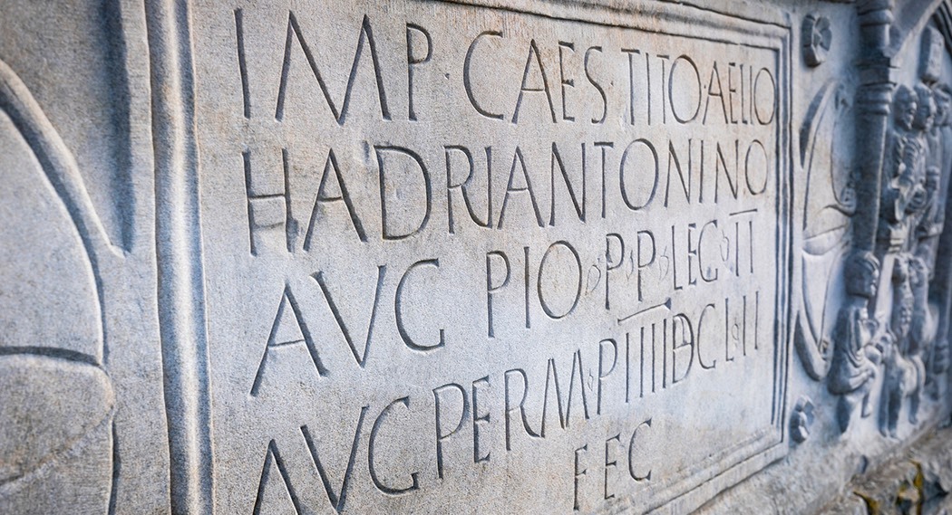
It was built on the orders of the Emperor Antoninus Pius around 142 AD, and overseen by Quintus Lollius Urbicus, a governor from North Africa.
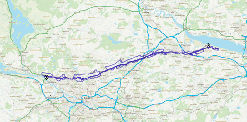
Today, the best-preserved fragments of the wall can be viewed at several main locations. These offer a snapshot of the original scale of the wall which remains impressive even today, carving a clear partition from the Firth of Forth to the banks of the Firth of Clyde. The route takes you though contrasts from tranquil country, farmland and ancient tracks, into towns and even cities.
- Measures 60 km (30m) in length from coast to coast.


Discover why the Antonine Wall is so special
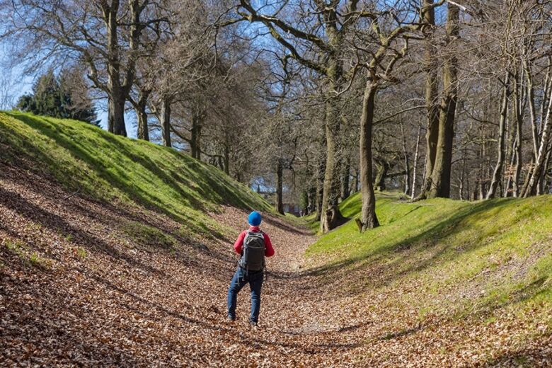
The Antonine Wall was not just the Roman Empire’s most northerly frontier. It was also one of the civilisation’s most sophisticated military constructions, as it exploits the defensive features of the landscape it runs through, using high ridges and steep drops to create a formidable barrier. Unlike Hadrian’s Wall which was built from stone, the Antonine Wall was composed of ramparts built from layers of turf and fronted by a wide and deep ditch to deter attackers, it served as a true state-of-the-art military installation.
An impressive Roman road, the Military Way, ran behind it and allowed the swift delivery of supplies, troops, and important news across the territory, making it the sustaining force of the last of the Roman Empire’s linear frontiers.
With many well-preserved sites to visit along the wall’s length, visitors can gain a vivid glimpse of the ingenuity of Roman infrastructure and what everyday life was like a Roman soldier stationed on the furthest flung outpost of the empire.
Replica distance slabs, sculptures and Roman themed playparks offer a more creative and less academic way of learning about the wall, making sure it’s accessible to people of all ages and interests.
The stories awaiting discovery along the Antonine Wall are so rich and diverse; like the many people now and in the past who have built, lived on, explored and maintained it.”
Explore the local area
There are traces of the Antonine Wall found across central Scotland, from the present-day towns of Bo’ness on the Firth of Forth to Old Kilpatrick on the Firth of Clyde. While most of these survive as remnants of ditches and turf banks, there are several especially well-preserved locations you can visit.
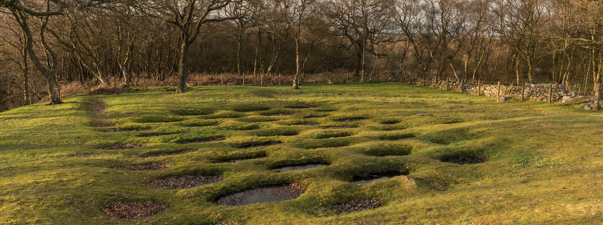
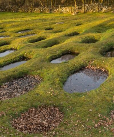
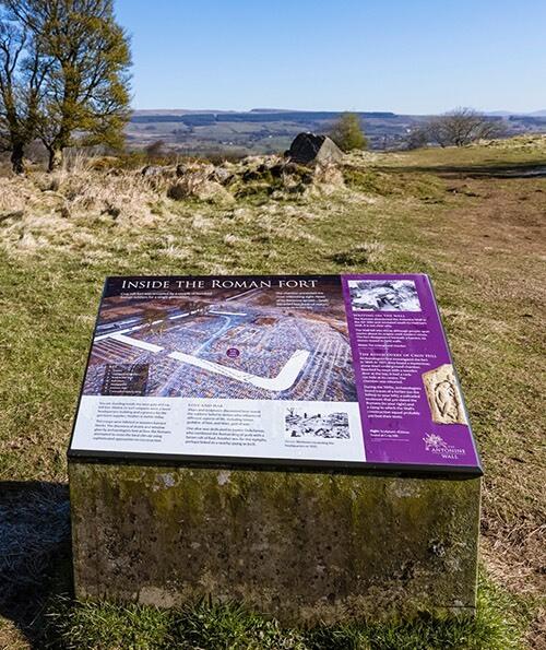
The best-preserved and most visible section of ditch and rampart can be found along the 8 km stretch at Watling Lodge in Falkirk, but you can also see the remains of forts, ramparts and even bathhouses at the following locations: Goldenhill Park, Duntocher (section of wall base), Bearsden (bathhouse), New Kilpatrick Cemetery (section of wall base) Bar Hill (fort, bathhouse and ditch), Croy Hill (ditch and site of fort), Castlecary (remains of one of only two stone built forts), Kinneil (fortlet), Callendar Park (ditch), Rough Castle (fort, ditch and lilia pits), Seabegs Wood (ditch and Military Way).
Look out for the replica distance slabs and Roman-themed playparks at Portpatrick Road, Old Kilpatrick; Goldenhill Park, Duntocher; Lambhill Stables and Monymusk Road in Glasgow; Peel Park, Kirkintilloch; Healthy Living Centre in Twechar; Auchinstarry; Callendar Park; Bonnybridge; Kinneil Estate; Cow Wynd in Falkirk; Bo’ness; Tamfourhill.
Sustainable local businesses
These Green Tourism businesses are assessed on everything from energy efficiency to biodiversity and awarded bronze, silver or gold.
We want Scotland's UNESCO Trail to be an opportunity to explore the country in a sustainable and responsible way.
Best Local Attractions & Experiences
We've highlighted some of the best sustainable businesses around the Antonine Wall.


How to get here
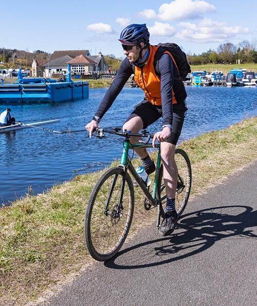
When you’re visiting sites and places connected to the Antonine Wall, there are many ways to get around. Central Scotland is well-served by public transport links including rail and bus. There is also an extensive cycle path network which makes getting around on bike easy.
It’s a fantastic area to explore on foot. You can discover the Antonine Wall at several locations along the iconic John Muir Way, a long-distance walking route which leads from coast to coast through central Scotland.
It can even be reached via water, from the Forth and Clyde Canal which runs parallel for much of the route of the wall.
Find ideas and tips for cycling and walking along and around the Antonine Wall
Find out more on getting to and around Loch Lomond, The Trossachs, Stirling & Forth Valley
Find out more about getting to and around Greater Glasgow & The Clyde Valley
Experience more UNESCO sites
Make the Antonine Wall part of a longer trip - we can help you plan a trip to all of the UNESCO sites in the local area, including Glasgow.
UNESCO Sites to Explore in Central West Scotland
In central west Scotland you have three UNESCO sites to discover - the Antonine Wall, New Lanark and Glasgow, City of Music.
View JourneyLearn more about UNESCO
The Antonine Wall is one of six UNESCO World Heritage Sites in Scotland. That’s quite the feat for such a compact country, and testament to the scope and richness of Scotland’s culture and history.
The Antonine Wall, Hadrian’s Wall, and the Upper German Raetian Limes all make up the Frontiers of the Roman Empire World Heritage Site. But the Antonine Wall represents the power and scope of the Roman Empire.
Read more about Scotland's UNESCO Trail and watch UNESCO: Explained video
United Nations Sustainable Development Goals
Every UNESCO designation tries to include the UN Sustainable Development Goals in their work.
WHAT ARE THE SUSTAINABLE DEVELOPMENT GOALS (SDGS)?
An urgent call for action from a global partnership of countries.
Recognise that ending poverty and other deprivations comes from strategies to:
- improve health and education
- reduce inequality
- encourage economic growth
- tackle climate change
Check out all the UN Sustainable Development Goals
Goal 3
Good Health & Wellbeing
The Antonine Wall offers valuable green space in what is a generally congested and developed areas. The wall runs through many communities that are significantly deprived but offers people easy access to outdoor spaces for walking, fresh air and mental health purposes.
Goal 4
Quality Education
There are significant opportunities for lifelong learning, both the interpretation sites and museums, but also through skills development programmes, training opportunities and volunteering. This is a life-long approach from early childhood in themed interpretive playparks to older age with Cycling Without Age trishaws.
Goal 11
Sustainable cities & communities
By working in collaboration with local communities, the designation aims to contribute to placemaking and regeneration in nearby cities, towns and villages. Skills development and capacity building ensures communities feel an ownership and engagement with the wall.
Useful links
More information
The Antonine WallVisiting the area
Loch Lomond, The Trossachs, Stirling & Forth Valley Glasgow & Clyde Valley Stirling iCentre Glasgow iCentre