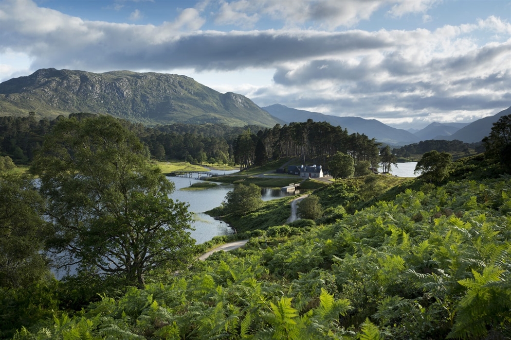
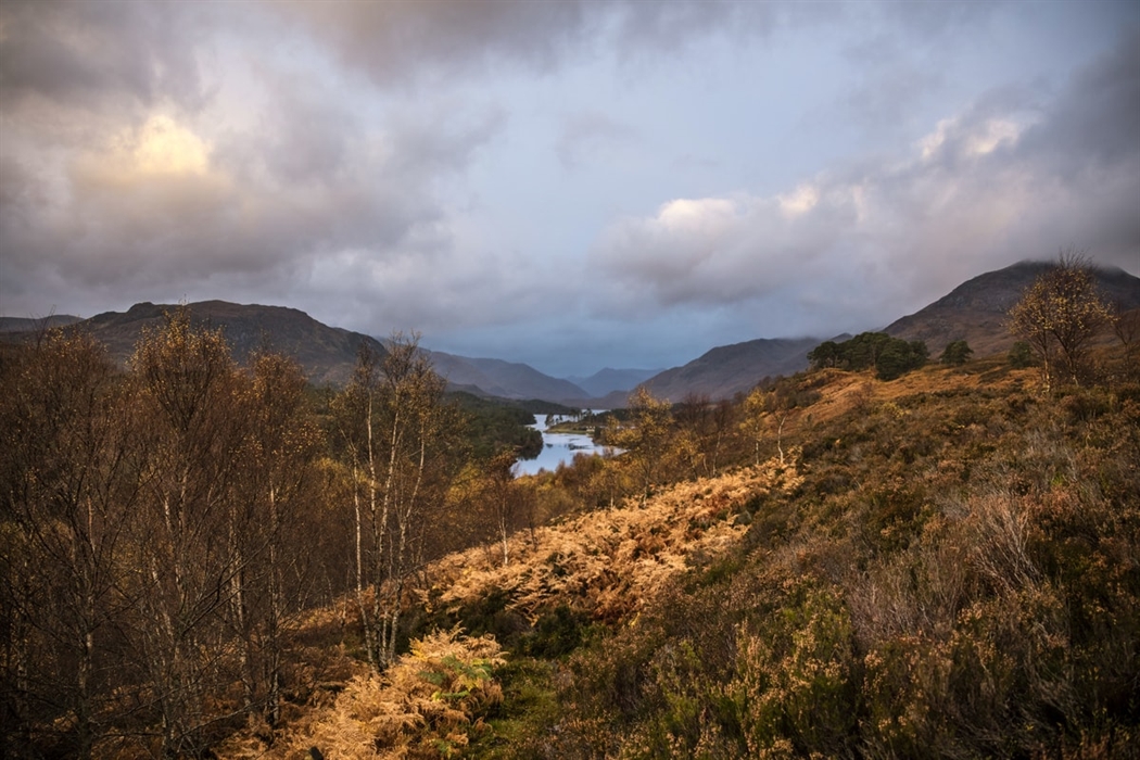
Explore the surviving remnants of this once great forest that covered vast areas of Scotland.
The Caledonian Forest was once a vast woodland that colonised most of Scotland. Formed at the end of the last ice age, it remains can be seen in the ancient pinewood of Glen Falloch and Tyndrum in The Loch Lomond & The Trossachs National Park. A unique ecoystem, these woods are home to a variety of rare flora and fauna, some of which aren’t found anywhere else in the British Isles.
Tyndrum is a small village situated 5 miles north of Crianlarich in the heart of the hillwalking...
The village of Crianlarich is located in Glen Strathfillan to the north of the Trossachs, some...
Bridge of Orchy is a small village located at the head of Glen Orchy.
Situated in the north part of Loch Lomond and the Trossachs National Park, Falls of Falloch is a...
Beinn Heasgarnich is a single Munro in the west of Perthshire.
Inverarnan is located by the river Falloch at the south end of Glen Falloch, near the head of Loch...
Ben More, the prominent landmark in Crianlarich village near Stirling, is the 16th highest mountain...
Ardlui is a village nestled on the northern shores of Loch Lomond in Loch Lomond & The Trossachs...
Dalmally is a small village spread along the Stratch of Orchy in Argyll & Bute 2 miles east of the...
Lochawe is a picturesque village located at the north end of Loch Awe, 3 miles west of Dalmally.
The village of Lochawe lies at the end of Loch Awe approximately 3 miles west of Dalmally.
Stuchd An Lochain & Meall Buidhe Range is two Munros in upper Glen Lyon in Perthshrie, close to the...
Eilean I Vow, known also as Eilean a' Bhò, is one of the small islands in Loch Lomond.
The small wooded Isle of Inveruglas on the shore of Loch Lomond is located within Inveruglas Bay...
The Arklet Burn at Inversnaid flows from Loch Arklet and falls into Loch Lomond via waterfall which...
The pretty hamlet of Inversnaid is situated on the north eastern shore of Loch Lomond.
Admire this stunning waterfall which cascades into Loch Lomond.
Loch an Daimh is a loch in Perthshire, 40 miles (64 km) west of Pitlochry.
The kirkton or village of Balquhidder lies at the head of Loch Voil, south west of Lochearnhead and...
The Tarmachan Ridge is the narrowest mountain ridge in Perthshire and is a rough and entertaining...
The village of Cairndow lies in an idyllic setting at the head of Loch Fyne, near the mouth of the...
Loch Katrine is a 13km-long fresh water loch in the heart of Loch Lomond & The Trossachs National...
The beautiful Falls of Dochart run through the small town of Killin, in Loch Lomond & The Trossachs...
Killin is a small attractive village on the Falls of Dochart, a spectacular series of rapids, at...
Glen Ogle extends 7 miles north west from Lochearnhead to Lix Troll, where it opens into Glen...
The small Tarbet Island on Loch Lomond is situated just off Tarbet on the mainland from where its...
Located near the head of Loch Long, Ben Arthur mountain boasts a spectacular skyline and fabulous...
This lofty range of mountains can be found to the north of Glen Croe and includes Ben Ime, the...
Tarbet is a small village situated on the east shores of Loch Lomond on a small neck of land that...
The village Arrochar is a popular gathering place for mountaineers due to its excellent road and...
Lochearnhead is situated at the western end of Loch Earn, a gently lapping Highland loch...
The highest point on the A83 is 803 ft above sea level and divides Glen Kinglas from Glen Croe.
Build your own itineraries by clicking the 'add to shortlist' button to add an item to your Itinerary basket.
For Accommodation and information, please call:
Open Mon to Fri: 0900 - 1700
Closed on Saturday & Sunday
*Calls may be recorded