10 Peaceful waterfall walks in Scotland
Scotland’s waterfalls change with the seasons, from winter drama to gentle summer cascades, lending a different kind of stillness to walks throughout the year. These peaceful waterfall routes are suited to unhurried days and mindful time outdoors.
The following list was created by VisitScotland to showcase a range of experiences. It isn’t ranked in any specific order.
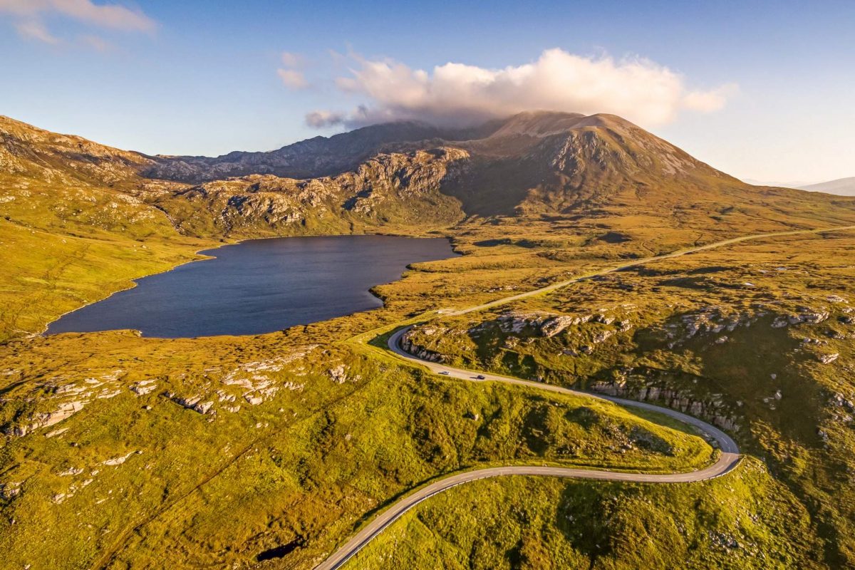
Grey Mare's Tail and Loch Skeen
Dumfries & Galloway
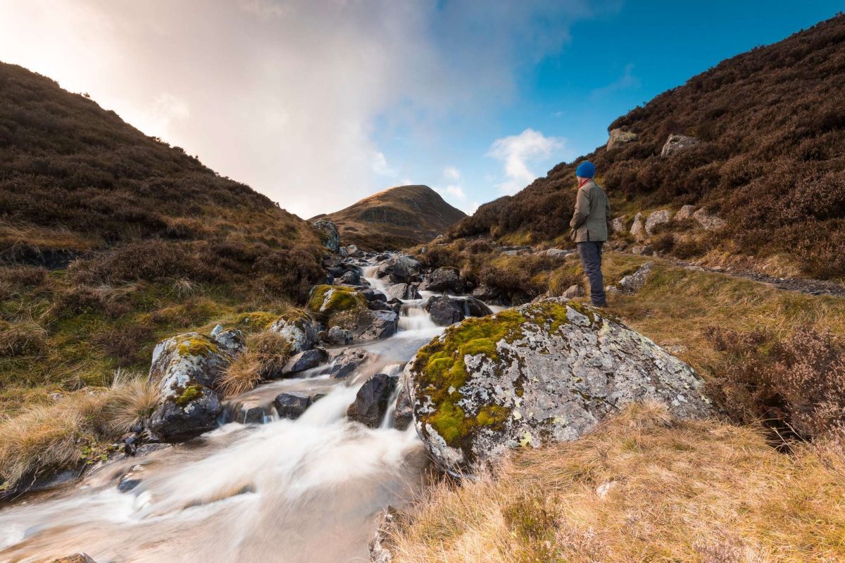
Grey Mare's Tail
Where: 10 miles north-east of Moffat
Distance: 3 miles/5 km
Grade: Steep
Terrain: A good hill path with a climb; care needed above the ravine.
Transport: Grey Mare’s Tail is 10 miles north-east of Moffat on the A708.
This spectacular waterfall plunges into the Moffat Water Valley. Set within a dramatic upland landscape, the walk follows the Grey Mare’s Tail path which runs very close to the falls.
Reaching the top of the falls provides a theatrical reveal of lovely Loch Skeen, overlooked by the peaks of Lochcraig Head, Mid Craig and the Corbett of White Coomb. For adventure seekers, this walk can be extended to climb the hills of the White Coomb horseshoe.
Linn of Ruthrie Falls
Moray Speyside
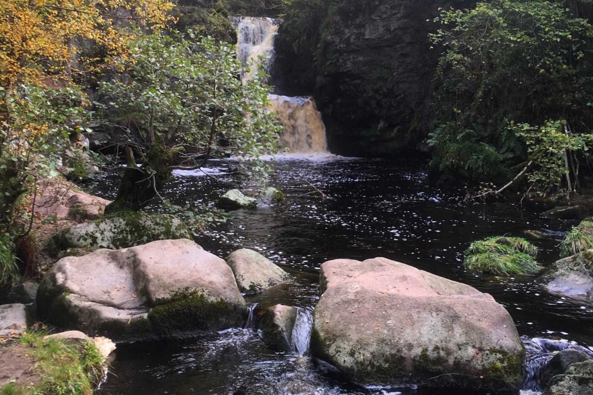
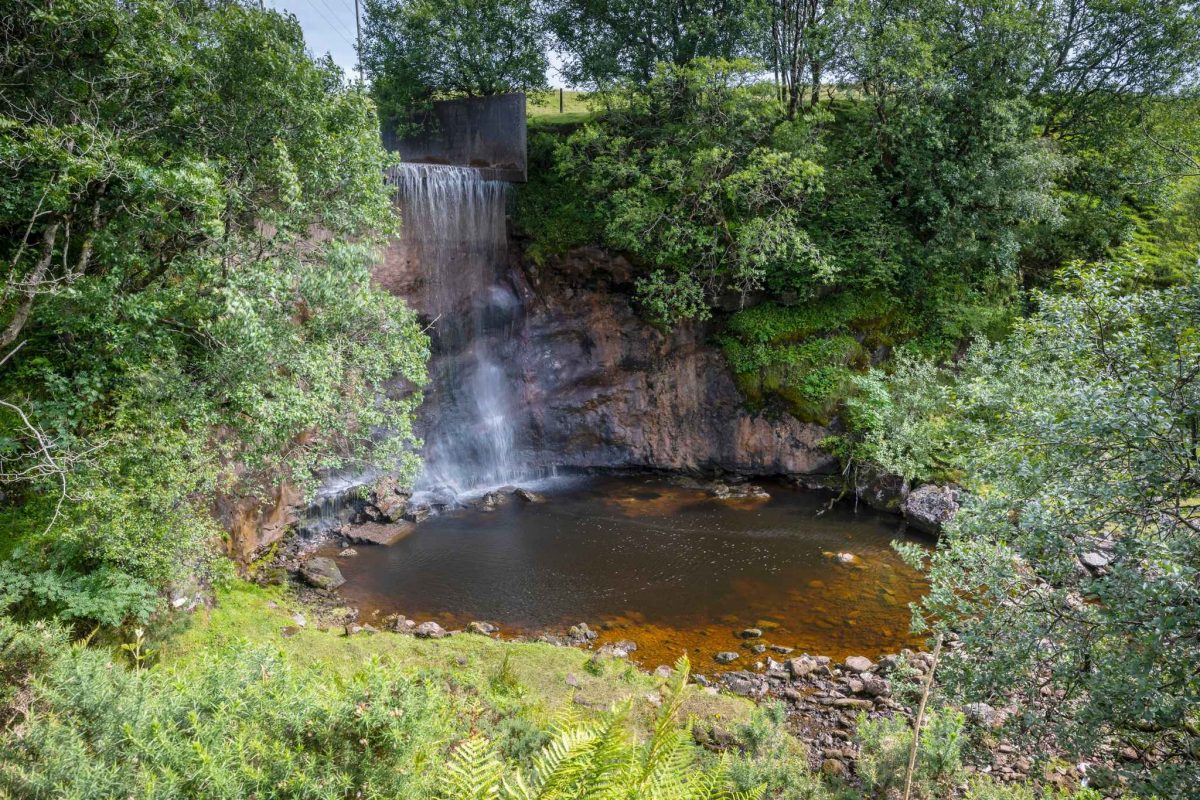
Linn of Ruthrie Falls
© @max.bennie96
Where: Charlestown of Aberlour, Moray Speyside
Distance: 2 miles/3.2 km
Grade: Easy
Terrain: A good woodland path with some wooden steps.
Transport: Bus services run to Aberlour from Elgin Bus Station.
This short walk, starting and finishing in Aberlour, takes you along the Aberlour Burn leading to the double-cascade Linn Falls. It’s not the biggest waterfall by any means, but its lovely setting will make it an enjoyable day out. Aberlour is also where delicious Walker’s Shortbread is made.
The route is signposted from Aberlour Distillery – ideal for a post-walk dram to round off your walk. This is also a great rest day walk for those walking the Speyside Way, which runs through the town on the way from Buckie in Moray.
Ramnahol Waterfall
Shetland
Ramnahol Falls
Where: Between Aith and East Burrafirth, Mainland, Shetland
Distance: 1 mile/1.5 km
Grade: Easy
Terrain: Well-constructed core path, with some steps and muddy sections.
Transport: The walk begins just off the B9071 where there is a small carpark.
Ramnahol Waterfall, or ‘pool of the ravens’ in Norse, is easily reached by a short path near the B9071 road, just beyond The Original Cake Fridge and Tea Shop, an ideal option for a post-walk snack.
Take the well-constructed path alongside the Burn of Lunklet, a Site of Special Scientific Interest, until you reach the falls, which are fed by the Loch of Lunklet further up. Extend the walk onto moorland beyond the falls, for fantastic views over the area.
Hallaig Falls
Isle of Raasay
Hallaig Falls
Where: Isle of Raasay, Highlands
Distance: 4 miles/6.5 km
Grade: Moderate
Terrain: A good waymarked grassy path, care required near the clifftop falls.
Transport: From the ferry terminal, drive south toward Inverarish, then follow signs for Fearns.
This waterfall walk offers stunning views towards the Cuillin mountains on Skye, towards Dùn Caan – the highest point on Raasay – and to the Scottish Highlands. Take a short detour from North Fearns to the ruined crofting township of Hallaig, which takes walkers to the Hallaig Falls, tumbling directly into the sea.
Hallaig township is immortalised in poet Sorley Maclean’s most important work, Hallaig. Maclean was born on Raasay in 1911 and wrote the poem to commentate on the clearance of the township 100 years earlier. The Isle of Raasay is a fabulous place to escape the everyday – don’t miss the local distillery.
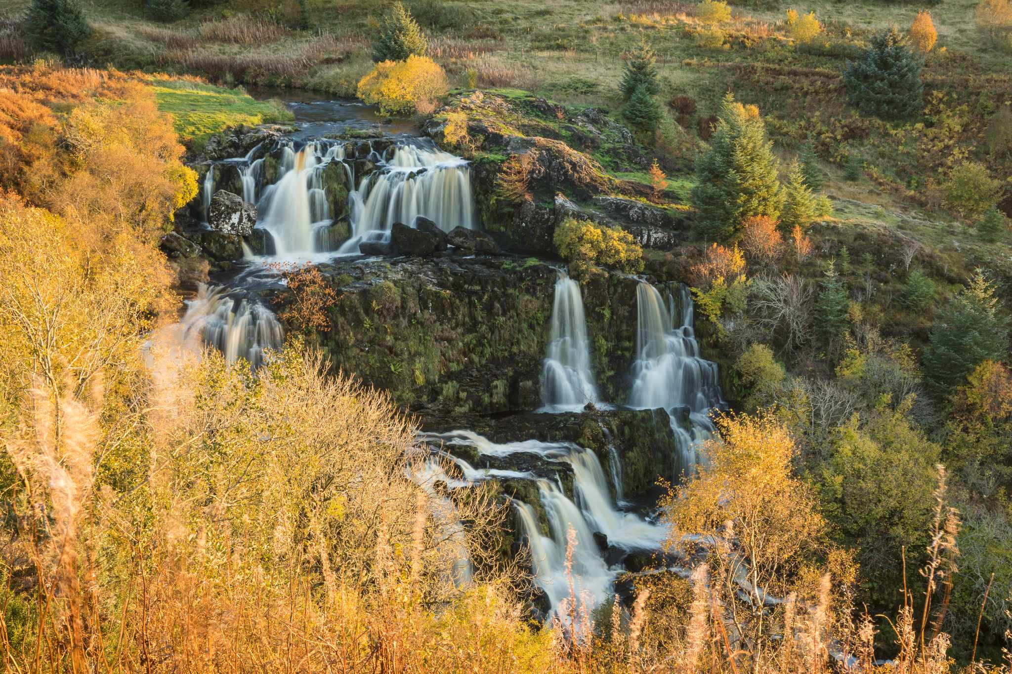
Greenock Cut
Inverclyde
Greenock Cut waterfall
Where: Clyde Muirshiel Regional Park, near Greenock.
Distance: 7 miles/11 km
Grade: Easy
Terrain: Well-maintained vehicle tracks and footpath.
Transport: Train services between Glasgow Central and Drumfochar stations – the Greenock Cut Visitor Centre is 3 miles from Drumfochar.
Drink in stunning views over the River Clyde, savour the rugged beauty of the regional park’s moorland, and tread the ancient cobbles of more than 20 beautiful stone bridges on this epic circular walk.
A highlight of the walk is the Greenock Cut itself – a 6.5-kilometre-long aqueduct built in the 19th century to carry water from the nearby Loch Thom reservoir to the town’s burgeoning industries. Now a designated Scheduled Monument, the Cut ends in a jaw-dropping waterfall that’s worth the walk all by itself.
Glenashdale Falls
Isle of Arran
Glenashdale Falls
Where: Whiting Bay, Isle of Arran
Distance: 3 miles/5 km
Grade: Moderate
Terrain: An uneven gravel and earth surface with some muddy sections.
Transport: Regular bus services run between Brodick and Whiting Bay.
This mystical waterfall route takes walkers through lovely woodland, and an area full of Iron Age and Neolithic history, to the 140-foot double-drop falls of Glenashdale on the Isle of Arran. A viewing platform offers a fantastic outlook over the falls.
The mysteries continue through woodland beyond the falls with lovely views of Holy Isle, before reaching the intriguing Giants’ Graves, set in a clearing. These two large and impressive Neolithic chambered tombs are over 5,000 years old, but were giants really buried here? There is also a fascinating Iron Age fort not far from the falls.
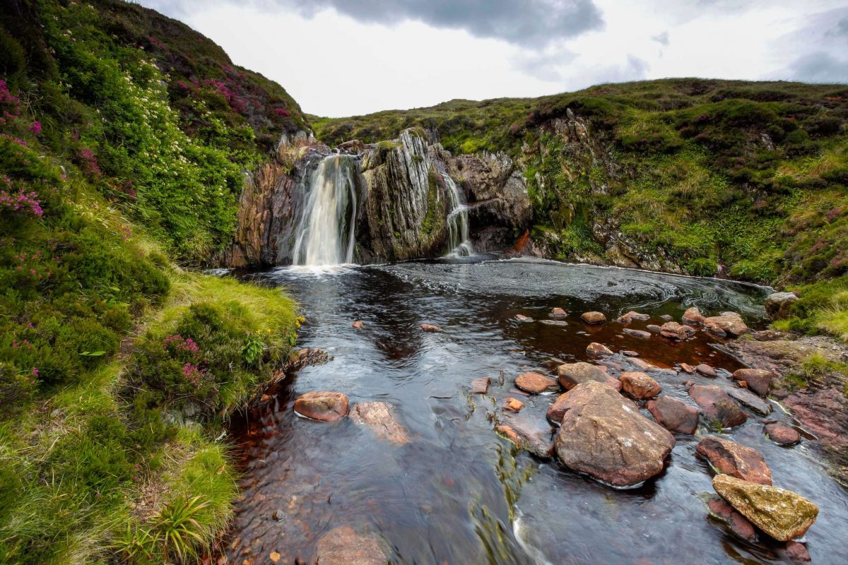
Loup of Fintry
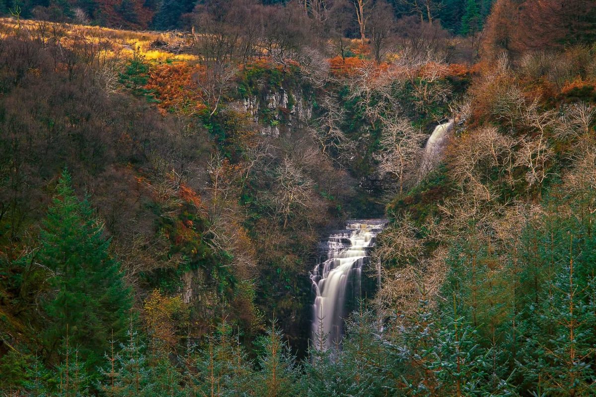
Stirling
The Loup of Fintry
Where: Near Fintry, Campsie Fells
Distance: ½ mile/1 km
Grade: Easy
Terrain: A good, if sometimes muddy, signposted footpath.
Transport: Easily accessible from Stirling and Glasgow, between a 30-50 minute drive.
Rising from the Gargunnock and Fintry hills, the Endrick Water snakes through some lovely Stirlingshire countryside, before dramatically dropping 94 feet over the Loup of Fintry and continuing on past Drymen and into Loch Lomond. This very short walk is well signposted not far from the village of Fintry and the falls are best seen after heavy rainfall. It’s a great place to relax and enjoy the scenery of the Campsie Fells.
Car parking is limited, so if it’s busy, the Pots of Gartness, also on the Endrick Water near Killearn, are close by and are a great spot to watch salmon jumping during the autumn months.
Black Spout Waterfall
Pitlochry
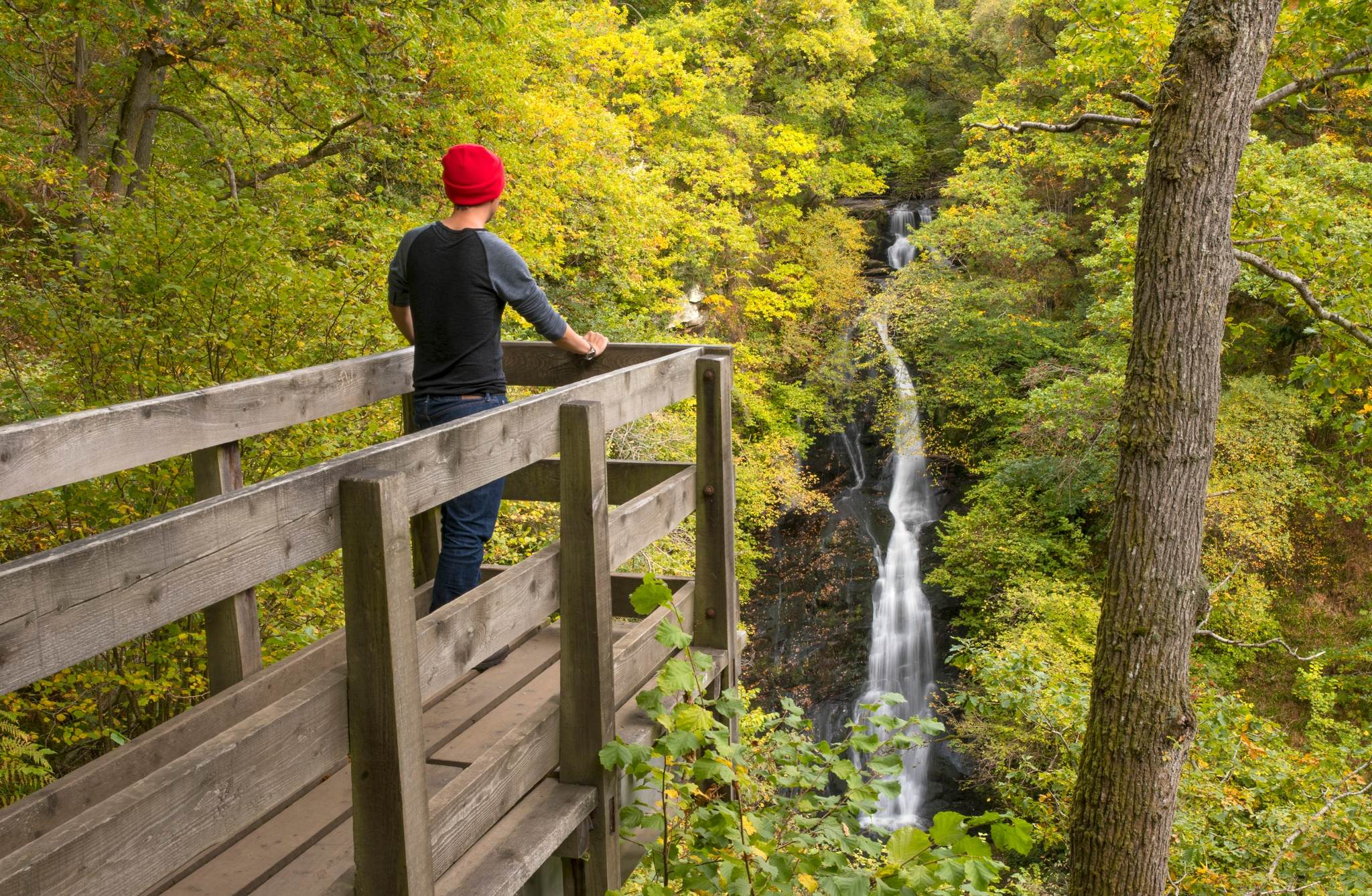
Black Spout Waterfall, Perthshire
Where: Pitlochry, Highland Perthshire
Distance: 3 miles/5 km
Grade: Easy (moderate if extending to include Moulin, then back to Pitlochry)
Terrain: A good woodland path, which can be muddy in places, pavement and minor roads.
Transport: There are regular train and bus services to Pitlochry.
Starting in the popular holiday town of Pitlochry, this walk makes its way up through lovely woodland beyond Blair Athol Distillery. The route leads to a platform perched over the Edradour Burn looking over to the 60 m Black Spout Waterfall. It’s a stunning setting, especially in autumn.
The walk continues along a narrow track, and you can extend your journey to include the Moulin Path. Here you can drop into the Moulin Inn and try their craft beers and something tasty to eat, before heading back to Pitlochry.
Eas a' Chual Aluinn Waterfall
Highlands
Loch na Gainmhich near the start of Eas a' Chual Aluinn
Where: Near Kylesku, Sutherland
Distance: 6 miles/10 km
Grade: Tricky
Terrain: A rough and, at times, faint path through rugged country. The route is boggy in places.
Transport: Parking area on bend on A894 between Kylesku and Lochinver junction
At 200 m, not only do you visit the UK’s highest waterfall, but a short detour near the start of the walk takes you to the hauntingly-named Wailing Widow Falls, at the outflow of Loch na Gainmhich.
The walk continues on along increasingly rough terrain, beyond the loch, leading to the top of the Eas a’ Chual Aluinn. Linger awhile and absorb the dramatic views over the falls and down Glen Coul to lochs Beag and Glencoul. When this cascade is in full flow, especially after heavy rainfall, it dwarfs Niagara Falls, which are only 51 m in height!
Eas Dubh a' Ghlinne Ghairbh
Highlands
Gairloch, Wester Ross
Where: Gruinard Bay, Wester Ross
Distance: 2 miles/3.2 km
Grade: Easy
Terrain: Rough terrain on a path that is muddy and faint for some sections.
Transport: Head for the Little Gruinard beach car park on the A832 in Wester Ross.
Set behind stunning Gruinard Bay, a short and steady climb up the Inverianvie River reveals the Eas Dubh a’ Ghlinne Ghairbh waterfall. From above the waterfall, the views back towards the bay are breathtaking. Relax here for a while and let the soothing sound of the falls awaken your senses.
If the bay is busy, there are lovely beaches nearby to explore, or visit Inverewe Garden close by. Remember to take care when driving on single-track roads and park responsibly at Gruinard Beach.
Safety first
When visiting waterfalls in Scotland, prioritise safety by staying on designated paths, keeping a safe distance from edges, and avoiding swimming near falls due to dangerous undercurrents and cold water. Surfaces can be slippery, so wear appropriate footwear and check weather forecasts, as rain increases hazards.
Always follow the Scottish Outdoor Access Code for responsible and safe enjoyment of the countryside.